alurail alurail
Home & Hub Live Journey Map Timetables Route Search Special Trains (KLB) Train Directory Fleet Database Station Directory Facilities & Depots Operating Areas Safety & Incidents Updates & News Photo Gallery alurail pass
User Suite
Map Home Timetables Fleet
alurail alurail
Hub / Home Directory & Insights
Live Journey Map Crowdsourced Live Journey
Timetables Train Schedules
Search Routes Direct & Transit Finder
Extraordinary Trains (EOT) Extraordinary Trains
Train Directory Master Train Fleet
Fleet Database Rolling Stock Info
Stations Facilities & Hubs
Facilities Depots & Workshops
Operating Areas Daop & Divre
Incidents & Safety (EOE) Historical Rail Incidents
Updates & News Railway Dispatches & Insights
Photo Gallery Curated Collection
alurail pass Supporter Perks
About alurail Platform Info & Vision
Sign In / Account
Back to Updates • Operations & Safety
Live Radar alurail Pass Submit Photo
Live Journey / Updates / Emergency at 3,742 Level Crossings: Train Air Brake Physics & Nationwide Holiday Safety Push
Operations & Safety 18 December 2025

Emergency at 3,742 Level Crossings: Train Air Brake Physics & Nationwide Holiday Safety Push

Evaluating 3,742 level crossings ahead of holiday travel: the mechanics of Westinghouse air brakes, 1,000-ton train inertia, Ministry Regulation 94/2018, and debunking track magnet myths.
Alurail Research & Editorial
Staff Writer & Rail Researcher • 1,620 views
Emergency at 3,742 Level Crossings: Train Air Brake Physics & Nationwide Holiday Safety Push
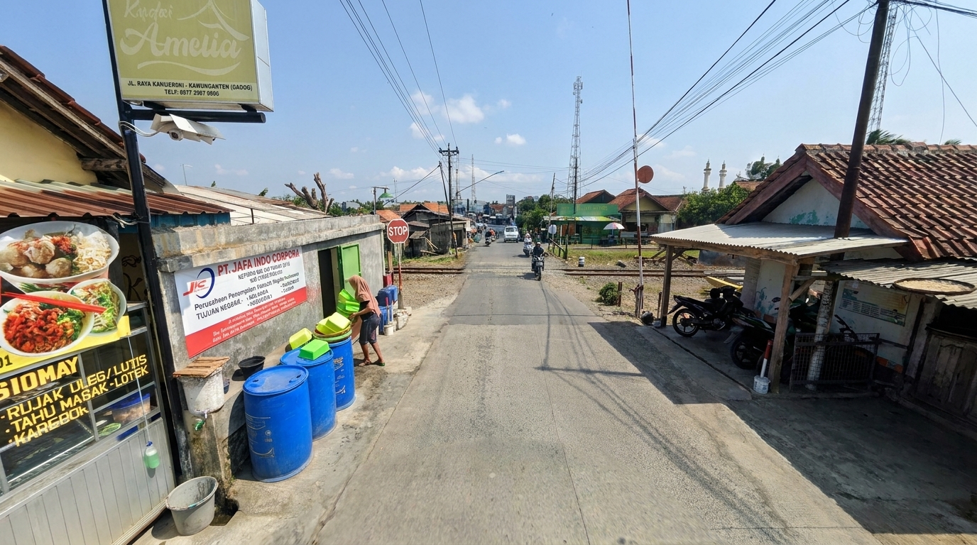
Approaching the peak holiday travel season of Christmas 2025 and New Year 2026, millions of highway vehicles converge with railway tracks across thousands of critical intersections. According to national safety audits, there are 3,742 level crossings across Java and Sumatra, the majority of which lack automated barrier gates. KAI is mobilizing intensive public awareness campaigns across 762 crossings to instill one unyielding law of physics: a multi-hundred-ton train cannot stop on demand!
Level Crossings
3,742 Sites
Recorded Track Intersections Across Java & Sumatra
National Campaigns
762 Points
Joint Enforcement: Police, Transport Ministry & KAI
Stopping Distance
500 – 1,000 m
Required for Full Emergency Halt at Track Speed
Inertial Mass
400 – 1,000 Tons
Locomotive and Fully Loaded Carriage Mass

1. National Risk Profile: The Reality of 3,742 Level Crossings Across Indonesia

Railway level crossings represent the most hazardous point of interface between trains operating on absolute right-of-way and heterogeneous vehicular road traffic. The PT KAI 2025 Sustainability Report (Pages 335–337 and 364–366) documents that out of 3,742 level crossings mapped across Java and Sumatra, more than half remain unguarded or lack official barrier gates.

This structural risk is compounded by road users who bypass warning barriers or traverse tracks when early warning bells are already active. Crossing collisions not only claim lives among motor vehicle occupants, but also endanger hundreds of train passengers, risk high-speed derailments, and damage electrical automatic interlocking gear.

Stopping Physics: Comparing Passenger Car vs Freight/Passenger Train Braking

Why trains cannot halt suddenly: Steel-on-steel friction coefficients and Newton's laws of inertia at 100 km/h cruising velocity.

Passenger Car (1.5 Tons, Rubber Tyres on Asphalt) ± 40 - 50 Meters • Friction Coefficient μ ≈ 0.7 - 0.8 (Rapid Kinetic Energy Absorption) CC 206 + 8-12 Coaches (Mass: 600 - 1,000 Tons) Railway Consist (Smooth Steel Wheels on Steel Rail) Emergency Braking Distance: 600 to 1,000 Meters! Newtonian Inertia: F = m × a. Dissipating the kinetic energy of a 600-ton train requires enormous stopping distance!

2. The Physics of Compressed Air Brakes: Why Trains Cannot Stop Instantly

A common public misconception assumes train drivers "refuse to brake" upon sighting vehicles stalled over crossings. This reflects fundamental misunderstandings of mechanical engineering:

  • Extremely Low Steel-on-Steel Friction: Rubber tyres on asphalt exhibit a friction coefficient of 0.7 to 0.8. In contrast, cast steel wheels on rolled steel rails exhibit a friction coefficient of only 0.15 to 0.25. While this minimal friction permits extraordinary energy efficiency in transit, it dramatically extends braking distances.
  • Massive Inertial Momentum: An intercity express consists of a 90–120 ton locomotive pulling 8 to 12 passenger carriages with an aggregate mass between 500 and 1,000 tons. At 100 km/h, kinetic energy reaches millions of Joules.
  • Pneumatic Air Pipe Propagation Latency: In Westinghouse pneumatic systems, dumping brake pipe pressure to trigger emergency braking travels as a pneumatic acoustic wave down a 300-meter train pipe, requiring 3 to 5 seconds before brake shoes across trailing cars achieve peak clamping force.
  • Derailment Catastrophe of Instant Locking: Attempting to instantly weld wheels would produce massive flat spots, melt rail heads, and cause trailing carriages to jackknife under compressive shockloads, triggering fatal passenger derailments.

3. Regulatory Jurisdictions: Who Owns Level Crossing Security Under Law?

Public inquiries frequently assign full responsibility for gate installations to PT KAI. However, under Law No. 23/2007 on Railways and Ministry of Transportation Regulation PM No. 94/2018, crossing safety is categorized strictly by roadway ownership:

Highway Classification Mandated Governing Authority Legal Safety Obligation
National Highways Ministry of Transportation (Central Government) Construction of grade-separated flyovers/underpasses and automated gates.
Provincial Roads Provincial Transportation Agencies (Dishub Provinsi) Manned barrier booths, certified gate operators, and roadside signage.
Regency / Municipal Roads Regency / Municipal Governments (Dishub Kota/Kab) Early warning acoustic alarms, roadway resurfacing, or closure of unauthorized crossings.
Village / Residential Roads Village Administration / Private Developers Must obtain legal regulatory permits or face permanent structural closure.
PT KAI (Persero) Role Railway Rolling Stock & Track Operator As the licensed transport operator, KAI prioritizes train transit safety, whistle warnings (Semboyan 35), and joint awareness campaigns with traffic police.

4. Dispelling the Urban Myth: Why Do Car Engines Stall Over Railway Tracks?

An enduring urban myth claims that "railway tracks emit powerful electromagnetic fields that drain car batteries and paralyze engine starters." In automotive and electrical engineering, this is ENTIRELY FICTITIOUS.

The true technical causes behind vehicle stalling on crossings are purely mechanical and psychological:

  1. Track Corrugations and Grade Elevation: Road transitions over steel rails involve sharp vertical height differentials. Drivers often enter crossings in too high a gear (2nd or 3rd) at slow speed, causing engine RPM to drop sharply and stall when hitting the steel lip.
  2. Driver Panic Reaction: Hearing a loud train horn or blaring crossing sirens, drivers with manual transmissions panic and release the clutch abruptly without sufficient throttle input, immediately killing the engine.

5. Emergency Survival Protocol: What to Do if Your Car Stalls on Tracks

If your vehicle stalls across a railway alignment, follow this immediate life-saving protocol:

  • Evacuate Everyone Immediately: Do not waste critical seconds continually turning the ignition key. Open doors and order all occupants (especially children and seniors) out of the car.
  • Flee Diagonally Towards the Approaching Train: Run away from the tracks at a 45-degree angle toward the direction from which the train is approaching. Why? Upon impact, high-speed wreckage and shattered metal fragments are projected violently forward in the direction of the train's motion.
  • Signal the Driver if the Line is Still Clear: If a train is far off in the distance, wave brightly colored clothing along the lineside shoulder to signal emergency stop conditions (Semboyan 3) to the crew.

Frequently Asked Questions (FAQ)

Is it true that railway tracks produce magnetic fields that stall car engines?

No, this is a myth. Railway tracks are passive carbon-manganese steel rails without electromagnetic emissions. Stalling is caused by rough rail bumps combined with driver clutch panic.

What distance does a train traveling at 100 km/h need to come to a complete emergency stop?

A train traveling at 100 km/h with an aggregate weight of 600 to 1,000 tons requires 600 to 1,000 meters to come to a full stop due to low steel-on-steel friction.

Who possesses legal authority to shut down illegal level crossings?

Under Ministry of Transportation Regulation PM 94/2018, central or regional governments according to road classification have the legal authority and obligation to permanently shut down unauthorized level crossings.
Key Takeaways & Assistive Q&A
Apakah rel kereta api memiliki medan magnet yang mematikan mesin mobil?
Tidak benar, itu hanya mitos. Rel kereta api tidak bermagnet. Mesin mati disebabkan oleh getaran bantalan rel dan kepanikan pengemudi yang melepas kopling mendadak.
Berapa jarak pengereman darurat kereta api berkecepatan 100 km/jam?
Dibutuhkan jarak 600 hingga 1.000 meter untuk berhenti total karena inersia bobot ratusan ton dan rendahnya koefisien gesek roda baja di atas rel.
Siapa yang bertanggung jawab memasang palang pintu perlintasan sebidang?
Sesuai Permenhub No. 94/2018, penanggung jawab adalah pemerintah pusat (Jalan Nasional), pemerintah provinsi (Jalan Provinsi), atau pemkab/pemkot (Jalan Kabupaten/Kota).

Related Dispatches

Officially Cancelled: PT KAI Halts 23 Used EMU Imports, Mandates 23 New Trainsets via PT INKA Flexible Production
Policy & Regulations

Officially Cancelled: PT KAI Halts 23 Used EMU Imports, Mandates 23 New Trainsets via PT INKA Flexible Production

Policy Rollback Analysis: Why PT KAI Canceled the Gapeka 2026 Train Consolidation and Renaming Plan
Policy & Analysis

Policy Rollback Analysis: Why PT KAI Canceled the Gapeka 2026 Train Consolidation and Renaming Plan

Planned Train Service Renaming and Fleet Consolidation in Gapeka 2026: Operational Implications & Headway Dynamics
Operations

Planned Train Service Renaming and Fleet Consolidation in Gapeka 2026: Operational Implications & Headway Dynamics

alurail alurail
Built upon GAPEKA 2025, visualized open-sourcedly with OpenRailwayMap and Leaflet.js. Powered by PostgreSQL (PostGIS, pgRouting), Dijkstra/A* Algorithms dan Viterbi Algorithm
Copyright ©️ 2024-2026 alurail by alula Made with 💗 from Pejaten, ID
Copyright ©️ 2024-2026 alurail by alula
Made with 💗 from Pejaten, ID

Community & Photographers

  • alurail Pass PRO
  • Submit Photo
  • User Suite
  • Curated Feed
  • Community Feed

Platform & Legal

  • About Platform
  • Terms & Conditions
  • Privacy Policy
  • Open Source Notices
  • FAQ / Help Center
Pass PRO PRO Upload Photo Suite Gallery
About
Terms
Privacy
License
FAQ
© 2026 alurail. All rights reserved.
alurail

alurail Legal & Info

About alurail

<h2>About AluRail</h2>

<p class="lead">
AluRail (Aluline TGV) is a free web-based platform that visualizes railway operations and train travel schedules across Indonesia. The service is available through <a href="https://aluline.id" target="_blank">aluline.id</a> and <a href="https://aluline.my.id" target="_blank">aluline.my.id</a>, developed independently by <strong>Alula</strong>
(<a href="https://alula.web.id" target="_blank">alula.web.id</a>) for railway enthusiasts (railfans) and passengers seeking a more intuitive understanding of train movements and timetable operations.
</p>

<h3>How It Works</h3>

<p>
AluRail transforms official <strong>GAPEKA 2025</strong> (Indonesia Railway Timetable Graph) data into an interactive geospatial visualization. Every train journey is reconstructed from scheduled departure and arrival times, station sequences, railway topology, and routing calculations to estimate how trains would move across the network.
</p>

<p>
Unlike conventional timetable viewers, AluRail continuously simulates train movement using a custom railway physics engine. The simulation considers various operational parameters including route geometry, train acceleration, braking, cruising speed, station dwell times, operational constraints, and other physical assumptions to estimate each train's position throughout its journey.
</p>

<p>
Whenever available, the platform also supports <strong>Crowdsourced Live Tracking</strong>. Passengers currently travelling on board may voluntarily share their GPS location. These telemetry reports are validated using map-matching algorithms and compared against the predicted GAPEKA route before being displayed to other users.
</p>

<h3>The Technology Behind AluRail</h3>

<ul>
<li><strong>PostgreSQL (PostGIS):</strong> Serves as the core geospatial database storing railway infrastructure, stations, and spatial relationships.</li>

<li><strong>Custom Railway Routing Engine:</strong> Implements graph-based routing algorithms including Dijkstra and A* to calculate railway paths, station connectivity, and operational routes.</li>

<li><strong>Railway Physics Engine:</strong> Simulates train movement by modelling acceleration, deceleration, cruising behaviour, station stops, speed restrictions, and travel progression based on timetable data.</li>

<li><strong>Viterbi Map-Matching:</strong> Validates crowdsourced GPS telemetry by matching noisy GPS observations onto the most probable railway track, improving live tracking reliability.</li>

<li><strong>Leaflet.js & OpenRailwayMap:</strong> Provide interactive map rendering and railway visualization layers.</li>
</ul>

<h3>Supported Railway Services</h3>

<p>
AluRail supports visualization for various railway services operating across Indonesia, including passenger, commuter, urban transit, heritage, and freight operations. Depending on data availability, the platform currently supports:
</p>

<ul>
<li>Intercity Passenger Trains (KA Antar Kota)</li>
<li>Whoosh High-Speed Railway</li>
<li>Commuter Line</li>
<li>Feeder Train Services</li>
<li>Local Passenger Trains</li>
<li>Freight Operations (Container, Cargo, Tanker, Coal, Cement and other freight services)</li>
<li>LRT Jakarta</li>
<li>LRT Jabodebek</li>
<li>LRT South Sumatra (Palembang)</li>
<li>Jakarta MRT</li>
<li>Ambarawa Heritage Railway</li>
</ul>

<p>
Additional railway operators and future services may be introduced as more infrastructure and timetable data become available.
</p>

<h3>Platform Features</h3>

<p>
AluRail combines timetable simulation, geospatial analysis, and live community participation into a single railway visualization platform. Key features include:
</p>

<ul>

<li>
<strong>Follow Mode</strong><br>
Automatically follows a selected train throughout its journey while continuously updating its estimated or live position.
</li>

<li>
<strong>Live GPS Cast</strong><br>
Passengers may voluntarily broadcast GPS telemetry while travelling onboard, allowing supported trains to display verified live positions instead of purely simulated movement.
</li>

<li>
<strong>Spotting Mode</strong><br>
Allows railfans to discover trains approaching nearby stations or railway crossings, making it easier to plan photography and train spotting activities.
</li>

<li>
<strong>Enhanced Railway Physics</strong><br>
Movement simulation considers railway gradient, elevation profile, track curvature, acceleration, braking, traction performance, speed restrictions, and operational constraints to produce more realistic train behaviour.
</li>

<li>
<strong>Detailed Route Analytics</strong><br>
Provides interactive charts including route elevation, curvature, gradient between stations, speed profile, and operational characteristics throughout the journey.
</li>

<li>
<strong>Train Information</strong><br>
Displays operational information about each service including operator, train category, route, schedule, formation details, and other service information.
</li>

<li>
<strong>Rolling Stock Database</strong><br>
Provides information about locomotives, EMUs, DMUs, coaches, wagons, and other railway vehicles used by supported services.
</li>

<li>
<strong>Coach & Class Information</strong><br>
Displays available passenger classes together with reference illustrations where available to help passengers identify onboard accommodation.
</li>
<li>
<strong>Adaptive Train Rendering</strong><br>
Train visualization automatically adjusts according to the current map zoom level. Different rendering modes are used to maintain smooth performance while displaying thousands of simultaneously simulated trains.
</li>

<li>
<strong>Train Filtering</strong><br>
Filter trains by service category such as Intercity, Commuter, High-Speed, Metro, LRT, Freight, Heritage, and other supported railway services.
</li>

<li>
<strong>Regional Filtering</strong><br>
Display trains operating within selected operational regions (Daerah Operasi / DAOP and other railway operational divisions) for easier monitoring.
</li>

<li>
<strong>Points of Interest (POI)</strong><br>
Explore railway-related locations including train spotting locations, photography viewpoints, railway landmarks, bridges, tunnels, stations, and other notable locations along the railway network.
</li>

<li>
<strong>Depots & Maintenance Facilities</strong><br>
View railway maintenance facilities including rolling stock depots, locomotive depots, maintenance workshops (Balai Yasa), stabling yards, and other operational infrastructure.
</li>

</ul>

<div class="disclaimer-box">
<h4>Disclaimer</h4>

<p>
<strong>AluRail is primarily a timetable simulation platform.</strong>
Unless a train is actively sharing verified Live Tracking data, all train positions displayed on the map are computational estimations generated from published schedules and the platform's railway physics engine.
</p>

<p>
Although the simulation attempts to realistically reproduce railway operations, actual train movements may differ significantly due to dispatching decisions, signal aspects, operational priorities, temporary speed restrictions, maintenance work, weather conditions, delays, early departures, extraordinary operations, GPS inaccuracies, or many other real-world factors that cannot always be observed by the platform.
</p>

<p>
Even when Live Tracking is available, GPS accuracy depends on user participation, mobile device quality, satellite reception, and local environmental conditions. Therefore, displayed positions should always be considered informational rather than authoritative.
</p>

<p>
<strong>This service must not be used as an official operational reference</strong> for travel planning, ticketing decisions, passenger information, or railway operations. Always refer to official PT Kereta Api Indonesia (Persero) information channels for accurate operational updates.
</p>

<p>
AluRail / Aluline TGV is an independent community project and is not affiliated with, endorsed by, partnered with, or officially associated with PT Kereta Api Indonesia (Persero), OpenStreetMap, OpenRailwayMap, or any other referenced organizations.
</p>
</div>

<p class="footer-note">
Made with ❣️ from Pejaten, Indonesia.
</p>

Terms of Use

<section id="terms-en" class="lang-content">
<h2>Terms of Service</h2>
<p class="effective-date"><strong>Effective Date:</strong> January 1, 2025 (Updated for GAPEKA 2025)</p>

<h3>1. Acceptance of Terms</h3>
<p>By accessing AluRail through aluline.id, aluline.my.id, and related subdomains (collectively, the "Service"), you acknowledge that you have read, understood, and agreed to these Terms of Service. If you do not agree, you must discontinue use of the Service.</p>

<h3>2. Independent Service</h3>
<p>AluRail is an independent community project developed by Alula. It is not affiliated with, endorsed by, or operated by any railway operator, government agency, or transportation authority unless explicitly stated.</p>

<h3>3. Nature of the Service</h3>
<p>The Service provides train schedule visualization, estimated train positions, operational simulations, and crowdsourced location validation based on publicly available information, GAPEKA data, and algorithmic processing. Displayed information may differ from actual railway operations.</p>

<h3>4. No Operational Guarantee</h3>
<p>Train movements, schedules, platform assignments, delays, cancellations, dispatching decisions, and operational conditions may change without notice. The Service must not be considered an official operational information source.</p>

<h3>5. Crowdsourced Contributions</h3>
<p>Users may voluntarily contribute GPS telemetry while onboard trains. Submission of fake GPS data, manipulated locations, automated submissions, spam, or attempts to interfere with system accuracy is strictly prohibited.</p>

<h3>6. Acceptable Use</h3>
<p>You agree not to misuse the Service, interfere with its infrastructure, reverse engineer protected components, exploit security vulnerabilities, scrape excessive data, or use automated systems that negatively impact platform availability.</p>

<h3>7. Intellectual Property</h3>
<p>Unless otherwise stated, the Service, its software, interface, branding, and original content remain the intellectual property of their respective owners. Open-source components remain governed by their own licenses.</p>

<h3>8. Availability</h3>
<p>The Service may be modified, suspended, restricted, or discontinued at any time without prior notice.</p>

<h3>9. Disclaimer ("AS IS")</h3>
<p>THE SERVICE IS PROVIDED "AS IS" AND "AS AVAILABLE" WITHOUT WARRANTIES OF ANY KIND, EXPRESS OR IMPLIED, INCLUDING MERCHANTABILITY, FITNESS FOR A PARTICULAR PURPOSE, NON-INFRINGEMENT, ACCURACY, OR CONTINUOUS AVAILABILITY.</p>

<h3>10. Limitation of Liability</h3>
<p>To the fullest extent permitted by law, Alula shall not be liable for direct, indirect, incidental, consequential, special, or punitive damages arising from the use of or inability to use the Service, including travel decisions, delays, missed connections, financial loss, personal injury, or data loss.</p>

<h3>11. Changes to these Terms</h3>
<p>These Terms may be updated periodically. Continued use of the Service constitutes acceptance of the revised Terms.</p>

<h3>12. Contact</h3>
<p>Questions regarding these Terms may be directed through the official AluRail contact channels.</p>
</section>

<h3>Independent Service Disclaimer</h3>

<p>AluRail is an independent community-developed platform created by Alula for railway visualization, research, educational, and enthusiast purposes.</p>

<p>AluRail is <strong>not affiliated with, associated with, authorized by, endorsed by, sponsored by, supported by, maintained by, operated by, or officially connected with</strong> PT Kereta Api Indonesia (Persero), PT Kereta Commuter Indonesia, PT Kereta Api Logistik, PT Kereta Api Pariwisata, PT Kereta Cepat Indonesia China (Whoosh), MRT Jakarta, LRT Jabodebek, LRT Jakarta, LRT Sumatera Selatan (Palembang), their subsidiaries, affiliates, successors, government agencies, transportation authorities, or any other railway operators unless explicitly stated.</p>

<p>All company names, railway service names, station names, train names, logos, trademarks, service marks, brands, route names, and other intellectual property displayed within the Service remain the property of their respective owners and are used solely for identification, informational, interoperability, historical, mapping, educational, or descriptive purposes.</p>

<p>The visualization presented by the Service represents publicly available operational information, algorithmic estimations, historical references, and voluntary community contributions. It must not be interpreted as an official operational system, railway dispatching platform, passenger information system, or real-time control center operated by any railway company.</p>

Privacy Policy

<section id="privacy-en" class="lang-content">
<h2>Privacy Policy</h2>
<p class="effective-date"><strong>Last Updated:</strong> June 2026</p>

<h3>1. Privacy Commitment</h3>
<p>Your privacy is important to us. We collect only the information reasonably necessary to operate and improve the Service.</p>

<h3>2. GPS Collection</h3>
<p>Your GPS location is accessed only after you intentionally enable Live Tracking. Background location is never collected without your explicit action.</p>

<h3>3. Processing</h3>
<p>Submitted GPS telemetry is processed using routing algorithms including Viterbi matching against the railway network to validate train positions. Telemetry is not associated with your personal identity.</p>

<h3>4. Server Logs</h3>
<p>Standard server logs such as IP address, browser type, timestamps, and technical diagnostics may be collected for security, abuse prevention, troubleshooting, and performance monitoring.</p>

<h3>5. Data Retention</h3>
<p>Live telemetry is temporary and automatically expires after the associated trip ends unless longer retention is required for security investigations.</p>

<h3>6. Third Parties</h3>
<p>We do not sell or rent your GPS telemetry. Limited technical processing by infrastructure providers may occur solely for operating the Service.</p>

<h3>7. Security</h3>
<p>Reasonable technical and organizational safeguards are implemented, although no online system can guarantee absolute security.</p>

<h3>8. User Safety</h3>
<p>We discourage publicly sharing real-time GPS positions. Anonymous mode or pseudonyms are strongly recommended.</p>

<h3>9. Your Responsibility</h3>
<p>Use of Live GPS or spotting features is entirely voluntary and at your own risk.</p>
</section>

Open Source Notices

<section id="opensource-en" class="lang-content">
<h2>Open Source Notice</h2>
<p>AluRail is built upon numerous open-source technologies and open data projects. We sincerely thank the communities maintaining them.</p>
<ul>
<li><strong>PostgreSQL, PostGIS & pgRouting</strong> — Spatial database, GIS extension, and routing engine.</li>
<li><strong>OpenStreetMap & OpenRailwayMap</strong> — Railway infrastructure and mapping data under their respective licenses.</li>
<li><strong>Leaflet.js</strong> — Interactive mapping library.</li>
</ul>
<p>All trademarks, copyrights, and licenses belong to their respective owners. Use within AluRail does not imply endorsement by those projects.</p>
</section>
alurail Pass Prime GRATIS!
early access

alurail Pass Prime GRATIS!